


Description
Garmin Montana 700 Rugged GPS Touchscreen Navigator

Track your adventures on any terrain.
Physical & Performance
| Display Size | 2.55″W x 4.25″H (6.48 x 10.80 cm); 5″ diag (12.70 cm) |
| Battery type | rechargeable lithium-ion (included) or 3 AA batteries (not included); lithium recommended |
| Display resolution | 480 x 800 pixels |
| GPS | Yes |
| Dimension | 3.4″ x 7.2″ x 1.3″ (8.76 x 18.30 x 3.27 cm) |
| Interface | high speed micro USB and NMEA 0183 compatible |
| Waterproof | IPX7 |
| Weight | 14.0 oz (397 g) with included lithium-ion battery pack |
| Display Type | WVGA transflective, dual orientation |
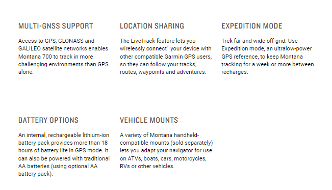
| Battery life | GPS Mode: up to 18 hours Expedition Mode: up to 330 hours |
| High-sensitivity receiver | Yes |
Maps & Navigation
| External memory storage | yes (32 GB max microSD™ card) |
| Waypoints/favorites/locations | 10000 |
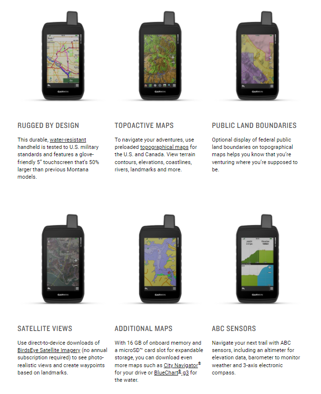
| Preloaded maps | yes (TopoActive, by region; Federal Public Lands maps, U.S. only) |
| Basemap | Yes |
| Navigation Routes | 250, 250 points per route; 50 points auto routing |
| Navigation Track Log | 20000 points, 250 saved gpx tracks, 300 saved fit activities |
| Memory/History | 16 GB (user space varies based on included mapping) |
| Ability to add maps | Yes |
Features
| Send route selection to MapShare during trip | No |
| BirdsEye | yes (direct to device) |
| Send waypoints to MapShare during trip | No |
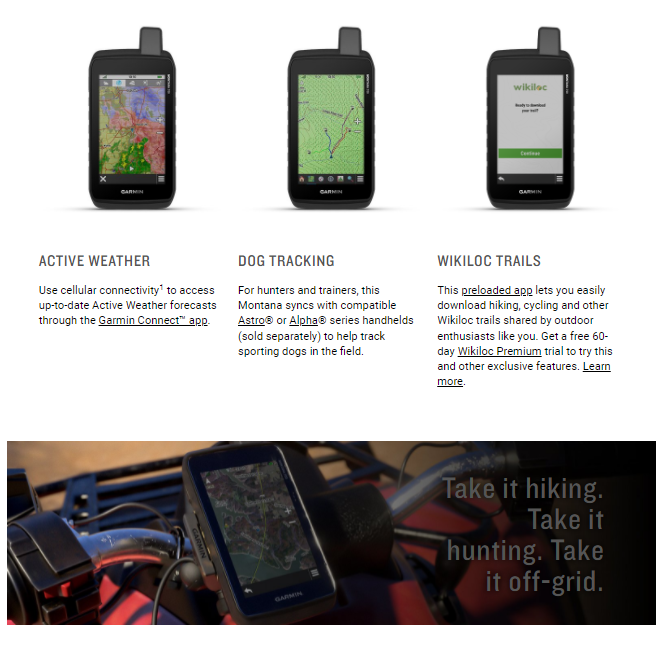
| Active Weather | Yes |
| Contacts | No |
| Rinex logging | Yes |
| inReach remote widget | Yes |
| Pairs with Garmin Connect™ Mobile | Yes |
| Touchscreen | Yes |
| LED beacon flashlight | Yes |
| inReach remote compatible | Yes |
| Sun and moon information | Yes |
| Virtual keyboard for custom messaging | No |
| MapShare compatible with tracking | No |
| Geocaching-friendly | yes (Geocache Live) |
| Send and receive text messages to other inReach device | No |
| GLONASS | Yes |
| Send and receive text messages to SMS and email | No |
| Frequency band | No |
| Displays national, state and local parks, forests, and wilderness areas | Yes |
| Smart notifications on handheld | Yes |
| Connect IQ™ (downloadable watch faces, data fields, widgets and apps) | Yes |
| Custom maps compatible | yes (500 custom map tiles) |
| Compatible with Earthmate | No |
| Dog tracking | yes (when paired to compatible dog track system) |
| Compatible with BaseCamp™ | Yes |
| Connections Wireless Connectivity | yes (Wi-Fi®, BLUETOOTH®, ANT+®) |
| LiveTrack | Yes |
| Exchange locations with other inReach device | No |
| Vibration alert | No |
| Map segments | 15000 |
| Point-to-point navigation | Yes |
| Picture viewer | Yes |
| Barometric altimeter | Yes |
| Weather | No |
| XERO™ Locations | Yes |
| Interactive SOS | No |
| VOX (voice activation) | No |
| Automatic routing (turn by turn routing on roads) for outdoor activities | Yes (with optional mapping for detailed roads) |
| GPS compass (while moving) | Yes |
| Includes detailed hydrographic features (coastlines, lake/river shorelines, wetlands and perennial and seasonal streams) | Yes |
| Includes searchable points of interests (parks, campgrounds, scenic lookouts and picnic sites) | Yes |
| Hunt/fish calendar | Yes |
| Compass | Yes (tilt-compensated 3-axis) |
| Compatible with Garmin Explore™ app | Yes |
| Tracks | 250 |
| Galileo | Yes |
| Garmin Explore website compatible | Yes |
| Area calculation | Yes |
| MIL-STD-810 | yes (thermal, shock, water, vibe) |
| Location reporting (send and receive GPS positions) | No |
| VIRB® Remote | Yes |

Reviews
There are no reviews yet.