
Description
Garmin 6.0″ Motorcycle Navigator zūmo® XT2
THE LIFE OF YOUR RIDE
You need throttle therapy. The zūmo XT2 motorcycle navigator is your prescription to hit the road, no matter where it goes. The bright 6” display is glove-friendly and packed with features to help you find the perfect motorcycle route.

The bright 6” display is easy to read, no matter the weather or light conditions.

Create custom routes with the visual route planner.

Find the twists and turns with the Garmin Adventurous Routing™ setting.

See popular moto paths to discover new places to ride.

Start a group ride to see positions of other riders on the zūmo XT2 display1.

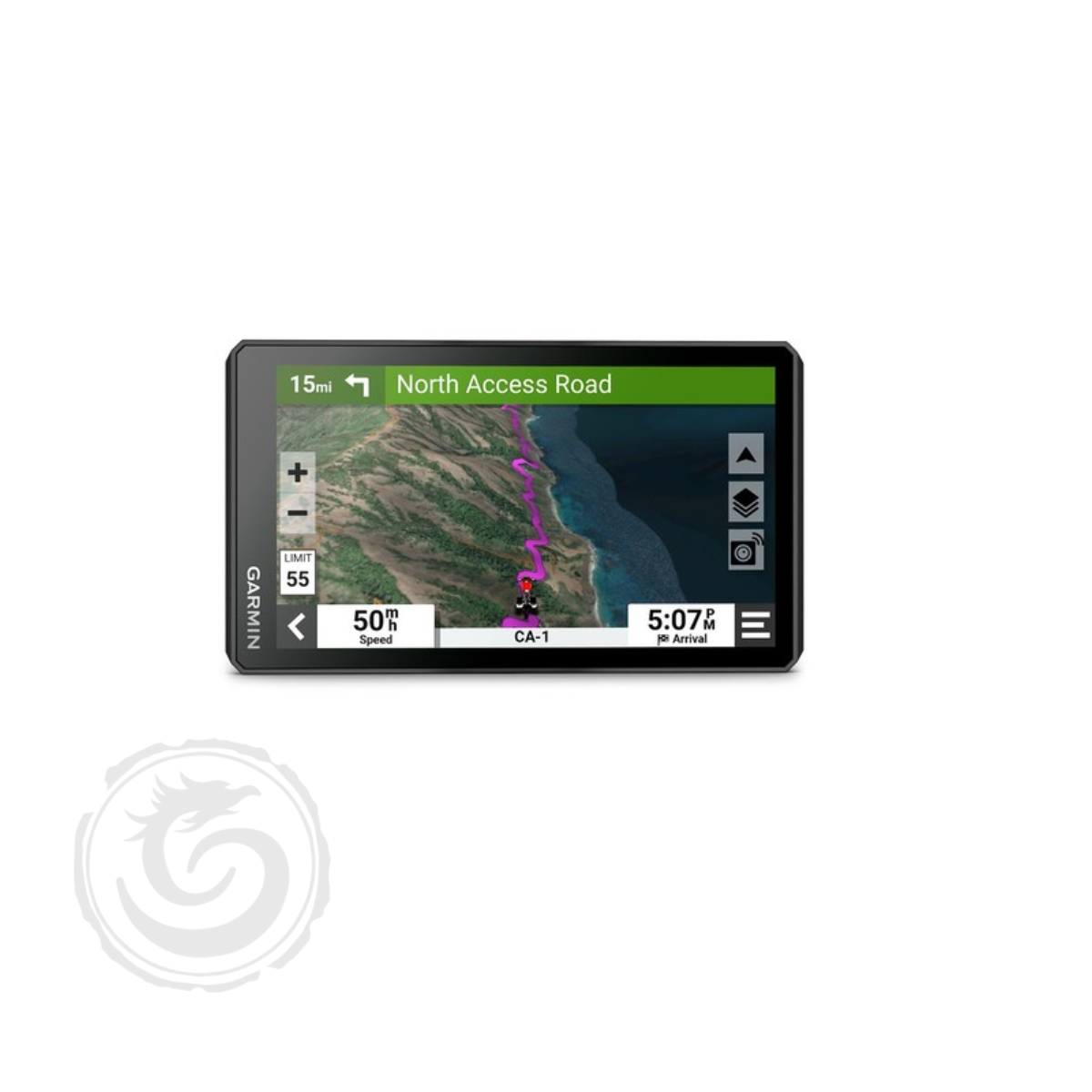
Switch from North America street maps to topographic maps to satellite imagery with just a tap.
TOP FEATURES
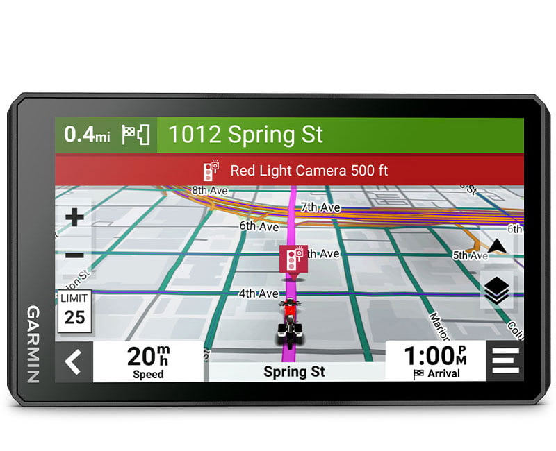 Ultrabright Display Ultrabright DisplayThe 6″ display is 15% larger than previous models and features an even brighter HD resolution in landscape or portrait mode. |
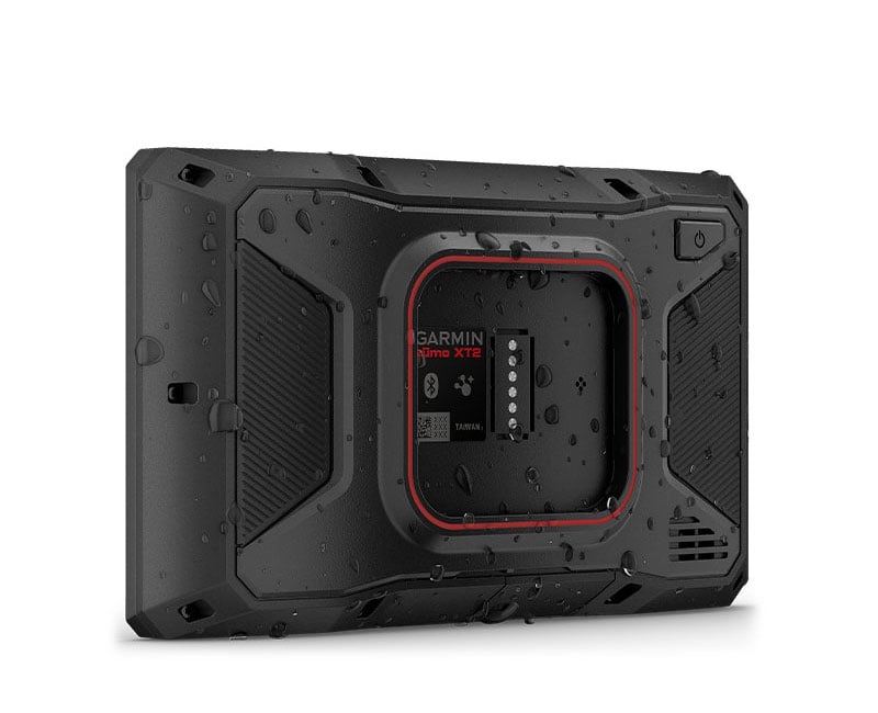
Designed to Endure |
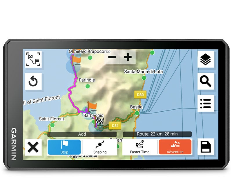
Visual Route Planner |
|---|---|---|
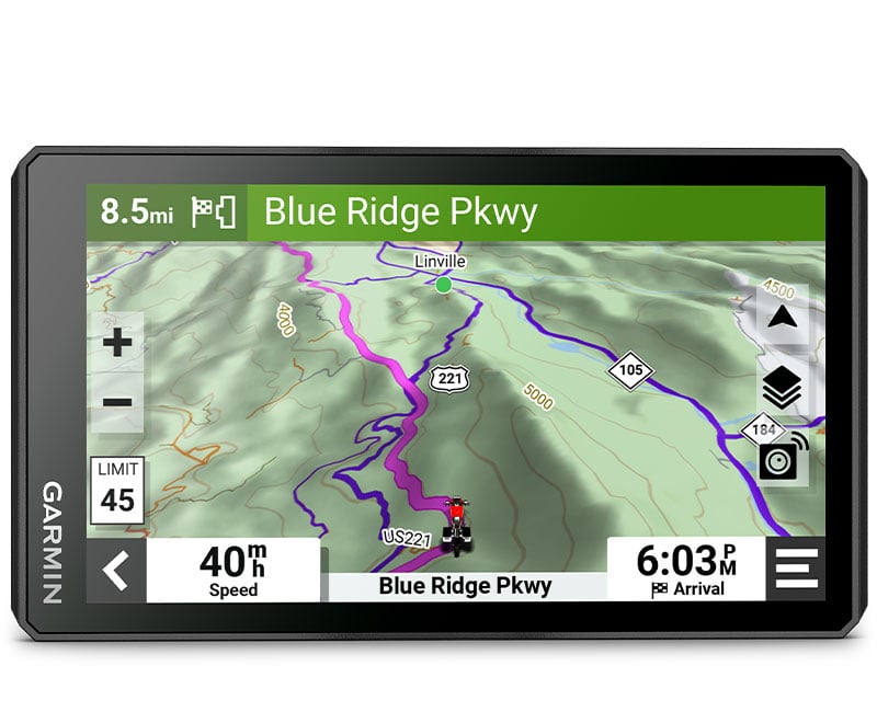
Simple Map Switching |
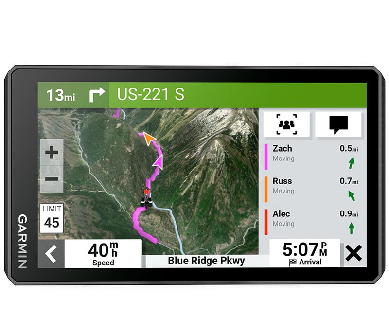
Group Tracking |
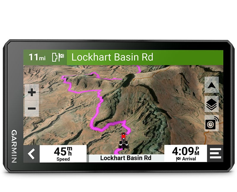 BirdsEye Direct Satellite Imagery BirdsEye Direct Satellite ImageryUse BirdsEye Direct Satellite Imagery from around the world to help you navigate. Download the maps directly to your device via Wi-Fi® technology³. No annual subscription required. |
DESIGNED FOR RIDERS. ENGINEERED FOR MOTORCYCLES.
NAVIGATION
| Great Rides | Popular Paths | Garmin Adventurous Routing |
| Find new routes on the Tread app. Bookmark them to automatically sync to your zūmo XT2 motorcycle navigator, and add difficulty ratings and upload photos to share with other riders. | See popular moto paths ridden by other riders to find new and exciting routes to explore. | Straight roads are boring. Find the most thrilling routes with hills, curves and sights, and choose from 4 levels of difficulty. |
| Ride Summaries | Track Recorder | Share Your Favorite Routes |
| Use the Tread app to review your ride details, including speed, acceleration, decelerations, elevation and more. | Record your ride data such as speed, distance, acceleration and more and share the details with friends on Tread app. | Easily send GPX files from your phone or third-party sources to your zūmo XT2 navigator. Share GPX files with fellow riders by using the Tread app. |
TRAVEL FEATURES
| Rider Alerts | Manage Your Data | Music |
|
Get alerts for hazards along your route, such as upcoming sharp curves, speed changes and more. You’ll also be notified about state helmet laws and red light/speed cameras⁴.
|
Easily manage⁵ tracks and routes across your navigator and compatible smartphone by using the Tread app.
|
Stream music from your smartphone through the zūmo XT2 navigator, or play MP3 files stored on the navigator — all to your connected helmet or headset.
|
CONNECTED FEATURES
| Wireless Updates | Live Traffic and Weather | Handlebar Controller |
|
Built-in Wi-Fi connectivity² makes it easy to keep your maps and software up to date without using a computer. On-screen cues show when new updates are available.
|
Access real-time traffic and weather, share routes with other riders, and get phone notifications via the Tread app⁵.
|
Get critical button control of your map, and keep your hands on the handlebars while riding, when paired with your wired handlebar controller accessory (sold separately).
|
| inReach® Compatibility | Bluetooth® Connectivity | Incident Notifications |
|
Pair zūmo XT2 with a compatible inReach satellite communicator⁶ for two-way messaging, location sharing and, in case of emergencies, SOS capabilities.
|
Hear turn-by-turn directions or stream music from your compatible smartphone through a connected helmet or headset.
|
If an incident occurs, a text message with location information is automatically sent to your predetermined contact⁵.
|
| Control Your Accessories | ||
|
Pair the zūmo XT2 motorcycle navigator with the compatible Garmin PowerSwitch™ digital switch box (sold separately) to enable on-screen control of your motorcycle’s 12-volt electronics.
|
||
General
| Feature | Specification |
| DIMENSION |
6.15″W x 3.5″H x 1″D (15.6 x 8.9 x 2.5 cm)
|
| WEIGHT |
12 ounces (340 g)
|
| WATER RATING |
IPX7
|
| DISPLAY TYPE |
multi-touch, glass, high brightness HD color TFT with white backlight
|
| DISPLAY SIZE |
5.3″W x 3.0″ H (13.3 x 7.5 cm); 6″ diag (15.3cm)
|
| DISPLAY RESOLUTION |
1280 x 720 pixels
|
| DUAL-ORIENTATION DISPLAY |
✔
|
| HANDLEBAR MOUNT (UP TO 1 INCH) |
✔
|
| DROP RATING |
MIL-STD-810
|
| BATTERY TYPE |
rechargeable lithium-ion
|
| BATTERY LIFE |
up to 7 hours (up to 5 hours at 100% backlight)
|
Maps & Memory
| Feature | Specification |
| DATA CARDS |
microSD™ card (not included)
|
| PRELOADED STREET MAPS |
✔
|
| 3D TERRAIN |
✔
|
| INTERNAL STORAGE |
32 GB
|
| ABILITY TO ADD MAPS |
✔
|
| EXTERNAL MEMORY STORAGE |
yes (256 GB max microSD™ card)
|
| INCLUDES MAP UPDATES |
✔
|
| DOWNLOADABLE SATELLITE IMAGERY |
yes (BirdsEye)
|
| BIRDSEYE DIRECT SATELLITE IMAGERY |
✔
|
| TOPO MAP SUPPORT |
✔
|
Sensors
| Feature | Specification |
| GPS |
✔
|
| GALILEO |
✔
|
| 10 HZ MULTI-GNSS POSITIONING |
✔
|
Outdoor Recreation
| Feature | Specification |
| PRELOADED TOPOGRAPHICAL MAPS |
✔
|
| NAVIGATE-A-TRACK NAVIGATION |
✔
|
Mapping & Navigation
| Feature | Specification |
| POINT-TO-POINT NAVIGATION |
✔
|
Camera Features
| Feature | Specification |
| BACKUP CAMERA COMPATIBLE |
yes (BC™ 50)
|
Navigation Features
| Feature | Specification |
| VISUAL ROUTE PLANNER |
✔
|
| GARMIN REAL DIRECTIONS™ LANDMARK GUIDANCE |
✔
|
| TRIPADVISOR® TRAVELER RATINGS |
✔
|
| ROUTE SHAPING THROUGH PREFERRED CITIES/STREETS |
✔
|
| INCLUDES TRAFFIC |
yes (with Garmin Tread app)
|
| LANE ASSIST WITH JUNCTION VIEW (DISPLAYS JUNCTION SIGNS) |
✔
|
| BLUETOOTH® PAIRING |
yes (works with BLUETOOTH-compatible helmet, headset or smartphone. BLE capable.)
|
| SPEED LIMIT INDICATOR (DISPLAYS SPEED LIMIT FOR MOST MAJOR ROADS IN THE U.S. AND EUROPE) |
✔
|
| DRIVER ALERTS FOR SHARP CURVES, SCHOOL ZONES, RED LIGHT AND SPEED CAMERA WARNINGS AND MORE |
✔
|
Advanced Features
| Feature | Specification |
| SMART NOTIFICATIONS VIA APP |
✔
|
| WI-FI® MAP AND SOFTWARE UPDATES |
✔
|
| ACCESS TO LIVE SERVICES VIA APP (TRAFFIC, WEATHER, ETC.) |
✔
|
Motorcycle Features
| Feature | Specification |
| CONTROL MUSIC AND MEDIA FROM SMARTPHONE OR MP3 PLAYER | ✔ |
| SUNLIGHT READABLE AND WEATHER RESISTANT | ✔ |
| GARMIN ADVENTUROUS ROUTING™ | ✔ |
| RIDER ALERT WARNINGS FOR SHARP CURVES, STATE HELMET LAWS, SPEED CAMERAS AND MORE | ✔ |
| PLANNED & DYNAMIC FUEL STOPS | ✔ |
| POPULAR PATHS (MOTO) | ✔ |
| ELEVATION PROFILE | ✔ |
| ROUND TRIP ROUTING | ✔ |
| TRACK SUPPORT | ✔ |
| CUSTOM MAP SUPPORT | ✔ |
| WIRELESS ANT+® TECHNOLOGY | ✔ |
Adventure Features
| Feature | Specification |
| PAIR WITH COMPATIBLE INREACH® DEVICES |
✔
|
| PAIR WITH GARMIN POWERSWITCH™ DIGITAL SWITCH BOX |
✔
|
| COMPATIBLE WITH GROUP RIDE RADIO |
Yes (6″, 8″ and 10″)
|
| GROUP RIDE MOBILE |
✔
|
| TRACK RECORDER (BREADCRUMBS) |
✔
|
| COMPATIBLE WITH THE GARMIN TREAD APP FOR ROUTE PLANNING AND DATA MANAGEMENT (WAYPOINTS, TRACKS, AND ROUTES) |
✔
|
| ULTIMATE PUBLIC CAMPGROUNDS |
✔
|
| BIRDSEYE SATELLITE IMAGERY (DOWNLOAD VIA WI-FI) |
✔
|
| GLOVE-FRIENDLY TOUCHSCREEN |
✔
|


Reviews
There are no reviews yet.